 View of Annapurna from outside Pokhara
This blog is a flash-back out of the 90 day Asia trip of 2006 back to a trek I did from Pokhara to the base of Annapurna in 1976, to give a more complete picture of Nepal and its mountains from our own experience and to provide a historical record of what the trek was like 35 years ago. Remember these are 35 year old half-frame Kodachrome slides with I have manually digitized using an old projector and a digital camera. For what they are they are a pretty sparkling record.
 Village houses at the beginning of the trek
 Modern map showing the journey. There is now a road nearly all the way to Birethanti.
 Annapurna lurks blue in the sky
 The trek begins up a river valley
The trek began with a long walk up a river valley with shingle flats ascending into rice or wheat paddies. This part has been partly replaced by a highway linking almost to Birethanti.
 A village at the valley's edge
 There is a continual traffic of people and horses, as this is a thoroughfare
 After a long flat walk we approach hills at the end of the valley route
The route then climbed out of the valley passing hill villages as it wound up and along a winding contour before descending into and crossing the valley leading out from Gandrung and the Annapurna cleft.
 Climbing into the hills we pass through this village
 We then follow a contour path along the highlands to the next river valley
 Everywhere, even on the steepest slopes, the land is contoured into paddies
 Although the path is narrow it is a major horse and walking highway
I had foolishly brought my main pack with all my belongings which made this a very hard slog, however I earned the respect of the many porters carrying everything from village needs to luxuries like crates of coca cola for the trekkers. In fact this narrow path was an ancient foot and horse highway traversed by many horse trains and porters and constructed like the paddies over centuries with careful stone work.


A view back of the path after folding out on the contour to the next hill
 We wind high above the next valley
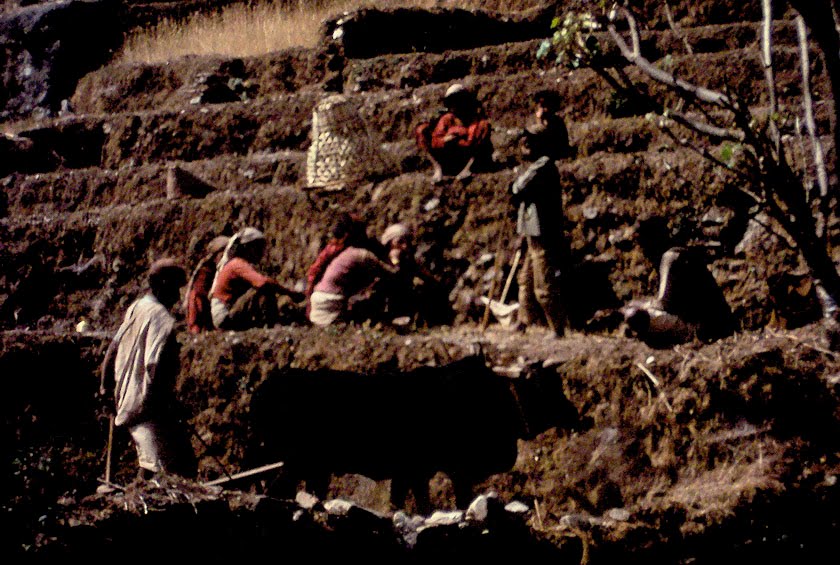 Workers in the fields
 The path becomes more precipitous
 As we turn further north we get sweeping views of the mountains ahead
Eventually the contour track turns and we can see the Annapurna mountain complex and the fish tail Machapuchhre, which now shows its blade-like twin peaks which you don't see from Pokhara.


We then descend precipitously to the river below to cross by the bridge at Birethanti
The path then descends all the way to the floor of the river valley, crossing the swing bridge at Birethanti.
 There is then a very steep climb up to the next row of foothills
From there the path climbs very steeply, turning into an almost endless set of rock stairs, interspersed with plinths often with a shade tree where a porter can rest their load in the shade on the way up.
 The path is all set in stone steps with resting places for those carrying heavy weights
 The view back down as we get nearer the top
 The path narrows and enters the forest
 The village, I think Ghorepani, where I stayed the night
I stayed overnight at what I think was Ghorepani a very musical little village with endless horse trains with shaking sounds of bells as they passed and houses made of hard wood spaced to let out the cooking smoke which rang out like xylophones when the rain fell on them at evening.
 The horse trains all jingled bells and the rain in the wooded slats rang like a xylophone
 The woman I stayed with nursing her child
 Shrines at the summit of the pass in the village
From there having enjoyed a view of the Annapurna range from a wilderness spot which must have been Poon Hill from comparable photographs taken by others, I set off on a very small path through the rhododendron forest to pass over to the track up to Annapurna Base Camp and Gandrung.
 A series of stunning mountain views from Poon Hill when it was simply wilderness
 Dhaulagiri "white mountain" summit 8167 m (26,542 ft)
 A recent digital image from the internet

 Rhododendron forest on the small connecting path to Annapurna
 A magnolia among the rhododendrons
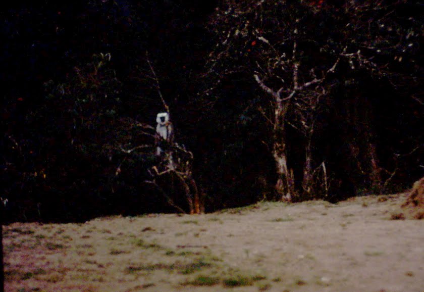 A wary monkey or gibbon
 The walking track became very remote and hard to follow
At one point there was a forking in the paths and I figured to take the left one after spying a group of climbers who had taken the right fork and ended up almost hanging to the cliffs further down.
 Eventually it would out over cliffs to the Annapurna valley
The path descended onto dense forest and I almost became completely lost with many small tracks winding here and there, until suddenly I met a band of almost naked men collecting bamboo poles for their village who then led me out to 'civilization'.
 After meeting men collecting bamboo I eventually reached what must have been Chomrong
I think this village must have been Chomrong where I again stayed before next morning setting off on the small winding path that led up to the Annapurna Base Camp.


 Excellent views of the mountains
 Machapuchhre glowing eerily in the evening.
The name means 'fish tail" and it is sacred to Shiva and prohibited to climbing.
 Next day I took the small precipitous path leading in to Annapurna base camp
The path wound into the head of the valley entering the mountain gorge with precipitous drops below.

 I enter the cleft of the valley
After stopping for a sojurn by a stream taking a psychedelic journey I found myself at Hinko Cave in a fezzing blizzard at dusk with a mountaineering team preparing to bed up in warm tents while all I had were my sneakers and a sleeping bag.
 It was snowing and freezing when I reached Hinko Cave where I had no tent
Next morning the weather was fine and cold, so I set off to see how far I could walk up to the base camp, which under these conditions could only be done in the first hour or so after dawn because of the high risk of avalanche as soon as the day began to warm.
 The weather was better in the morning
 I then began to try a very early morning walk to the base camp before avalanches set in
 The base camp is just above the fork in the valley ahead
However because of the blizzard the night before I rapidly found myself walking nearly up to my knees in snow and my feet covered only in sneaker rapidly became numb, so I had to turn back to save myself from a grizzly fate.
 However the snow was 2 ft deep and I froze and had to return
 On the way back out of the valley to Gandrung

I then trekked down the valley to Gandrung where I stayed in relative comfort. The night was filled with drumming which seemed to be a form of communication with the village of Landrung opposite across the valley which was a full days hike away down to the river and up again as you could also hear the drums talking on the other side of the valley in the distance.
 Staying at the inn at Gandrung
 Landrung across the valley communicated by drum beat in the evening
The journey across took all day going down tot he river and back up

 My flute playing friend attracts a crown of children

From there I descended in a long sweep down the valley back to the track out to Pokhara.
 On the way down the valley out again
No comments:
Post a Comment