
Well we got up to leave Kathmandu at 5.50, but as usual had to wait before a stranger appeared to take us to our bus which we had to walk three or four blocks to. The day was raining steadily with little hope of visibility and we were all crammed into a midi-bus, which fortunately Christine guided us into the back seat of where there was a window we could open.
Although it was dark misty and raining cats and dogs, this led to a rather climactic journey through flooded cataracts adding to the atmosphere and giving a good view of the pass once I found some additional internet images in finer weather to complement the ones we took.

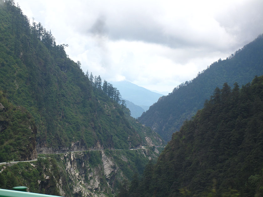
We first traveled East in the Kathmandu valley and then up a long ravine that grew steadily steeper with torrential water flows from the last of the monsoon rains. I did get some good shots of the wild water-streaming Himalayan foothills.


Eventually we wound up an atrocious road to the Nepali border.


We then had to walk up the last kilometre at Kodari just about carrying everything on my back because the road was blocked with trucks. In the process I lost my cell phone which was on global roaming and could have cost a fortune at $5 a minute if anyone had picked it up and used it, it was possible for a person talking for a couple of hours even on local calls to rack up a visa fee of around $600. The lesson - always put a sim lock on your phone and travel with it turned right off to make sure the sim lock gets activated if anyone tries to use it.
 Kodari - an unseemly place to depart Nepal

We ended up stranded at the Friendship Bridge for hours in the drizzle firstly because we lost contact with our second tour guide for Tibet and then longer because the convoy coming the other way from Lhasa was stuck in a traffic jam in the narrow winding streets of Zangmu above.
 Friendship Bridge China direction
 Friendship Bridge Nepal direction
Then we coupled up with a third Tibetan guide who we were not introduced to by the last and got as far as Zhangmu, changed some money, got through border control, and then passed up a precipitous set of hairpins in dense fog to Nyalam at around 3600 metres or about 12,000 feet.


 An internet image showing the road up to Zhangmu in better weather conditions
 Zhangmu


 Internet images of this section winding in steep hairpins up a nearly sheer valley


 Internet image of this section. You can see the same hairpin in our misty photo above


I immediately got into a humdinger of an argument with the guide because we were chucked into a dormitory room and he refused to admit that we had ongoing tickets to Chengdu as our travel agent had said. In the middle of this melee I discovered that my cell phone had been ripped of the pack and on global roaming without a pass key. So in addition to altitude sickness, my mouth was dry from fear that all our funds would vanish overnight.
I thus ran up the street and found a little drink shop with China mobile and found I could phone our son Rohan directly for about $1 a minute and he managed to cancel global roaming. Nevertheless both Christine and I hardly slept a wink with dry mouths headaches, drinking and pissing all night with me having cell phone nightmares.
In the morning I phoned my daughter Arwen as well and got her to double check they had followed Rohan's cancellation order and find out how much had actually been racked up in fees. To our delight it was only $3.90 so its possible the cell phone got run over by a truck at the border.
 Nyalam-mu - gateway to hell - as Tibetans living on the open altitudes see the valley

No comments:
Post a Comment